Best GPS Units for Marking Utah Fishing Spots
There's nothing quite as frustrating as having an incredible day out on the water, finding that perfect fishing spot where the bite was just on fire, and then returning a week later only to realize you can't quite remember how to get back to it. Was it that rock pile? That specific bend in the river? Or that subtle drop-off near the submerged timber? It's a common dilemma for every angler, but thankfully, modern technology offers a brilliant solution. This comprehensive guide will walk you through everything you need to know about choosing and using the best GPS units for marking your favorite Utah fishing spots, ensuring you can revisit those honey holes again and again with pinpoint accuracy.
Why a GPS Unit is a Game-Changer for Utah Anglers
Imagine the sheer frustration of hitting a fishing nirvana — a submerged ledge where walleye are stacked, a hidden spring creek pocket holding trophy browns, or a deep-water hummock loaded with fat lake trout. You catch fish, you have a blast, and you swear you'll remember it forever. Then, next time you're out, the landscape looks subtly different, the light is wrong, and that "unforgettable" spot becomes agonizingly elusive. A GPS unit isn't just a gadget; it's your personal memory bank for every productive cast, every structure you discover, and every strategic move you make on the water.
Never Lose That Hot Spot Again
The truth is, many of Utah's best fishing spots aren't marked with buoys or giant neon signs. They're often subtle, underwater features: a rocky point extending into a deep channel, a specific depth where a thermocline sets up, or a scattered patch of weeds that holds baitfish. Without a way to precisely log these coordinates, you're relying purely on visual memory and guesswork, which can be incredibly unreliable, especially on vast, featureless reservoirs or winding rivers.
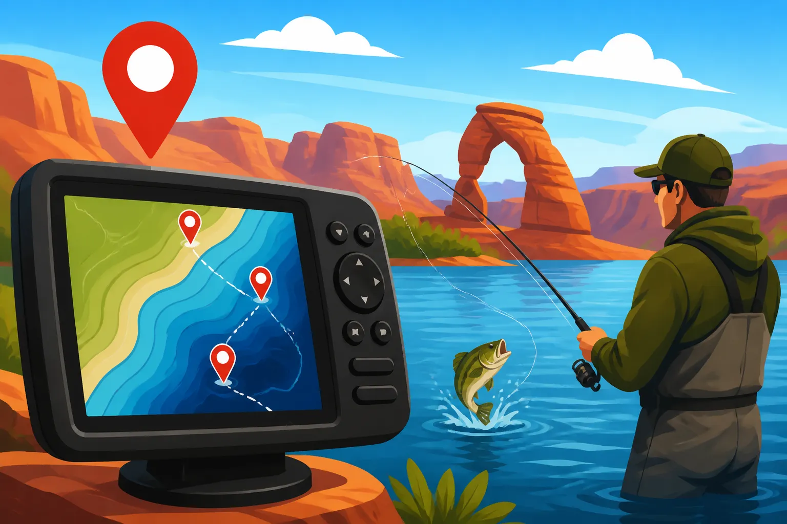
A good GPS unit allows you to drop a "waypoint" with the press of a button, instantly recording the exact latitude and longitude of your position. You can then name this waypoint something memorable, like "Walleye Ledge 5/10" or "Big Trout Hump," and even add notes about the depth, conditions, or species caught. This capability takes all the guesswork out of returning. You can motor right back to that exact spot, knowing you're putting your bait or lure precisely where the fish were last biting. It saves precious fishing time and significantly increases your chances of repeating success. On a huge body of water like Flaming Gorge or Lake Powell, this precision is absolutely invaluable, transforming endless searching into targeted fishing.
Navigating Utah's Diverse Waters with Confidence
Utah's fishing landscape is incredibly diverse, from the expansive open waters of Bear Lake and Strawberry Reservoir to the winding, often swift, currents of the Provo River or Green River, and even the isolated, high-altitude lakes of the Uinta Mountains. Each environment presents its own navigational challenges. A GPS unit enhances not only your fishing strategy but also your safety and overall confidence.
On large lakes, weather can change in an instant. A clear morning can quickly turn into a whiteout squall, making it difficult to find your way back to the boat ramp or camp. Having your routes and key landmarks saved on a GPS provides a crucial layer of safety, guiding you through fog or heavy chop. For those adventurous souls who venture into the backcountry for Uinta Mountains High Lakes Fishing, a reliable handheld GPS is non-negotiable. It helps you navigate trails, locate remote lakes, and ensure you can find your way back to your vehicle, especially if you're taking a multi-day trip and need to manage your How to Pack Fishing Gear for a Backpacking Trip to Uinta Lakes. Even on rivers, a GPS can help you track your drift, identify specific riffles or pools, and safely navigate around hazards like submerged rocks or logjams, especially if you're wading or floating unfamiliar stretches.
Understanding Different Types of GPS Units for Fishing
When you start looking at GPS units, you'll quickly realize there's a wide spectrum of options, each designed with different types of anglers and budgets in mind. Knowing the differences between them is key to picking the right tool for your specific fishing adventures in Utah.
Handheld GPS Units for Portability and Versatility
Think of handheld GPS units as your sturdy, go-anywhere companions. These devices are typically compact, rugged, and powered by standard or rechargeable batteries, making them perfect for situations where you're not tied to a boat's power source. They often feature bright, but smaller, screens and are designed for portability.
Pros:
- Portability: Their small size means they easily fit in a pocket, tackle box, or strapped to a backpack. This makes them ideal for wade fishing Utah's many rivers, shore fishing at community ponds, or exploring those remote high-altitude lakes in the Uintas.
- Battery Life: Many handhelds boast impressive battery life, often running for 10-20 hours on a single charge or set of AA batteries, which is perfect for extended trips where recharging isn't an option.
- Versatility: Beyond fishing, these units are excellent for hiking, hunting, geocaching, or general backcountry navigation, offering track logging, route planning, and basic mapping features.
- Durability: They're built to withstand drops, splashes, and rough outdoor conditions.
Cons:
- Smaller Screen: The compact size means a smaller screen, which can make viewing detailed maps or complex data a bit more challenging, especially in bright sunlight.
- Less Detailed Mapping (Sometimes): While many come with excellent base maps, ultra-detailed bathymetric charts for specific Utah reservoirs might be an additional purchase or less granular compared to dedicated boat units.
- No Direct Sonar Integration: Handhelds are solely GPS devices; they don't integrate with sonar transducers to show you fish arches or underwater structure in real-time.
For anglers who spend most of their time fishing on foot, from a kayak, or in small, unpowered boats, a handheld GPS offers incredible value. They are an affordable entry point into GPS navigation and a reliable backup even for boat owners. You can often find a good selection of these on platforms like Amazon, allowing you to compare features and prices easily.
Chartplotters and Fish Finders Combo Units for Boats
These are the big guns of marine electronics, typically found mounted at the helm of fishing boats. As the name suggests, they combine a full-featured GPS chartplotter with a powerful sonar fish finder into a single, integrated display. These units are designed for serious boat anglers who need comprehensive data at their fingertips.
Pros:
- Large, Detailed Displays: With screen sizes ranging from 5 inches up to massive 16-inch or larger units, these offer clear, high-resolution views of maps, sonar returns, and navigation data. This is crucial for interpreting complex underwater contours and spotting subtle fish signals.
- Real-time Sonar Integration: This is where combo units truly shine. They allow you to see what's directly beneath and around your boat in real-time – fish, structure, depth, and even bait schools. You can instantly mark a waypoint on your screen when you spot a promising fish arch or a crucial piece of cover. Learning to interpret these sonar signals is a skill in itself, and you can dive deeper into it with guides like How to Read a Fish Finder for Utah Reservoirs.
- Advanced Mapping: Most combo units come pre-loaded with highly detailed lake maps (chart data) including bathymetric contours, navigation markers, and points of interest. Many offer options for even more enhanced mapping, such as satellite overlays and custom chart creation.
- Powerful Processing and Networking: These units often have robust processors, allowing for quick map redraws and seamless switching between screens. Many can be networked together with other boat electronics like radar, trolling motors, and even engine data, creating a fully integrated system.
- Specific Fishing Features: Look for features like side imaging, down imaging, 3D sonar, and custom waypoint icons to distinguish between different types of spots (e.g., "trout," "bass," "structure").
Cons:
- Mounted on a Boat: They are not portable and require a dedicated power source from your boat's electrical system.
- Higher Cost: Due to their advanced technology and comprehensive features, combo units are significantly more expensive than handheld GPS devices.
- Learning Curve: With so many features and settings, there can be a steeper learning curve to fully utilize all their capabilities.
For serious boat anglers tackling Utah's larger reservoirs, a high-quality chartplotter/fish finder combo unit is an indispensable tool. If you're looking for one, places like Bass Pro Shops often have a wide array of options and knowledgeable staff who can help you compare models and features. For more guidance, check out articles like Best Fish Finders for Utah Reservoirs.
Mobile Apps and Smartphone GPS
In an age where almost everyone carries a smartphone, it's tempting to rely on apps for your fishing navigation needs. Many excellent apps are available that turn your phone into a capable GPS device, complete with mapping and waypoint features.
Pros:
- Convenience: You likely already own a smartphone, so there's no additional hardware to buy beyond possibly a rugged case or mounting solution.
- Cost-Effective: Many basic fishing GPS apps are free, while premium versions with enhanced features and maps are often available as a low-cost subscription or one-time purchase.
- Community Features: Some apps offer community-sourced fishing reports, shared waypoints (use with caution and discretion!), and social features that can be quite engaging.
- Ease of Use: Most smartphone interfaces are intuitive and familiar to users.
Cons:
- Battery Drain: Running a GPS app with the screen on can quickly deplete your phone's battery, leaving you without communication or navigation when you need it most. External battery packs are almost a necessity.
- Durability and Waterproofing: Most smartphones are not designed for the rigors of a fishing environment. They are vulnerable to water damage, drops, and extreme temperatures. While waterproof cases help, they aren't foolproof.
- Screen Glare: Smartphone screens can be difficult to view in bright sunlight, a common occurrence on Utah's waters.
- Reliability in Remote Areas: While GPS functions independently of cell service, detailed map downloads or online features may suffer in remote areas with no signal.
- No Sonar Integration: Like handheld units, phone apps don't typically integrate with boat sonar directly, although some dedicated fish finders can cast their sonar display to a phone app via Wi-Fi.
For casual anglers, beginners, or as a backup to a dedicated unit, a smartphone GPS app can be a great tool. However, for critical navigation or serious fishing, a dedicated GPS unit offers superior reliability, durability, and features tailored for the angling environment.
Key Features to Look for in a Fishing GPS Unit
Choosing a GPS unit isn't just about picking one off the shelf; it's about matching its capabilities to your specific needs and the types of water you fish in Utah. Let's break down the essential features that will make the biggest difference in your fishing experience.
Mapping and Chart Details
This is arguably the most critical feature. A GPS unit without good maps is like having a car without a road. For fishing, you want highly detailed bathymetric charts, which are essentially underwater topographical maps. These show you:
- Depth Contours: Lines indicating changes in depth, revealing drop-offs, ledges, humps, and channels where fish often congregate.
- Navigational Aids: Markers for channels, buoys, and hazards (though you should always rely on visual cues too).
- Bottom Composition: Some advanced maps might even indicate areas of rock, sand, or mud, which can influence fish location.
- Points of Interest (POIs): Locations of boat ramps, marinas, fishing access points, and sometimes even known fishing hot spots.
Look for units that come with detailed pre-loaded maps for Utah's major lakes and rivers. Some brands offer proprietary map cards that provide even greater detail, including high-resolution satellite imagery or 3D views. These are often an extra investment but can be well worth it for serious anglers. Make sure to check if the unit supports updates to these maps, as lake beds and river channels can change over time. The more granular the detail, especially in terms of depth, the better you can pinpoint structure for species like smallmouth bass or walleye.
Waypoint Management and Storage
What good is finding a spot if you can't save it or find it later? This feature is all about your ability to mark, organize, and revisit those productive locations.
- Waypoint Capacity: How many individual spots can the unit store? More is always better, as you'll accumulate dozens, if not hundreds, over time. Aim for at least 1,000 waypoints for serious fishing.
- Ease of Marking: Can you drop a waypoint with a single button press? Can you easily rename it on the fly with a clear identifier (e.g., "SRP_Walleye_Hump" for Strawberry Reservoir walleye)?
- Categorization: Advanced units allow you to assign categories or icons to waypoints (e.g., a fish icon for a productive spot, an anchor for a safe overnight mooring). This helps tremendously with organization as your library grows.
- Track Logging: This feature records your entire path on the water, creating a "breadcrumb trail." This is invaluable for reviewing your successful trolling passes, understanding drift patterns, or simply finding your way back along a complex route. You can save these tracks and even convert parts of them into new waypoints.
Effective waypoint management transforms random luck into repeatable success. It's how you build a personal database of knowledge about Best Places to Fish in Utah.
Screen Size, Resolution, and Durability
These physical aspects are crucial for usability and longevity, especially given Utah's sometimes harsh outdoor conditions.
- Screen Size: For boat units, bigger is generally better. A larger screen makes it easier to view maps, interpret sonar, and navigate menus without squinting. For handhelds, it's a trade-off between portability and viewable area.
- Resolution: Higher resolution (more pixels) means clearer, sharper images and maps. This is especially important for discerning subtle details on sonar or intricate map contours.
- Sunlight Readability: Utah's intense sun can wash out many screens. Look for units with transflective displays or very bright backlighting that perform well in direct sunlight. Test it if you can!
- Durability and Waterproofing: Your GPS unit will likely get wet, jostled, and perhaps even dropped. Look for rugged construction and a high IPX rating (e.g., IPX7 or IPX8), indicating it can withstand immersion in water. A marine-grade unit is designed to withstand salt spray, vibrations, and temperature extremes.
Battery Life and Power Options
How your unit is powered and how long it lasts can make or break your trip.
- Handheld Units: Focus on extended battery life. Many run on AA or AAA batteries, which are easily swapped in the field. Others have rechargeable internal batteries. Consider carrying spare batteries or a portable power bank.
- Boat Units: These typically wire directly into your boat's 12V electrical system. Ensure your boat's electrical system is robust enough to handle the unit's power draw, especially if you're running multiple electronics. Consider a dedicated marine battery for your electronics if you have a lot of gear.
- Backup Power: Regardless of your primary unit, always have a backup plan. A fully charged smartphone with a mapping app (and a portable charger!) can be a lifesaver if your main unit fails or runs out of juice unexpectedly.
Thinking through these features will help you narrow down your choices and find a GPS unit that genuinely enhances your Utah fishing experience, rather than becoming another piece of unused gear.
Integrating GPS into Your Utah Fishing Strategy
A GPS unit is far more than just a navigational tool; it's a strategic weapon in your angling arsenal. By understanding how to effectively use its features, you can unlock new levels of success and safety on Utah's waters.
Marking Productive Structure and Cover
Fish are creatures of habit and structure. They relate to changes in depth, submerged objects, and cover for safety, ambush points, and foraging. Your GPS unit allows you to precisely document these key areas, turning your observations into actionable data.
- Underwater Topography: Use your combo unit's sonar (if you have one) or your unit's detailed maps to identify submerged humps, sharp drop-offs, ledges, and deep channels. Mark them instantly. For example, if you find a specific depth where smallmouth bass are schooling, you can mark that contour line and replicate your presentation. This is especially effective when learning How to Fish Deep Structure for Smallmouth in Fall.
- Cover Types: Spotting submerged timber, brush piles, or weed lines on your sonar? Mark them. These areas provide excellent ambush points for predator fish and shelter for baitfish. Remember, even subtle changes in bottom composition can be a "structure" to a fish.
- Transition Zones: Fish often hold where different types of cover or depth meet. Marking these transition lines, like where a rocky bottom turns to sand, can be incredibly productive. For instance, finding these transition zones can be key to success when trying to learn How to Catch Walleye at Utah Lake in Spring.
By consistently marking these features, you build a detailed personal map of where fish are likely to be, saving you countless hours of aimless searching on future trips.
Tracking Trolling Passes and Drift Lines
For many Utah anglers, especially those targeting kokanee salmon or lake trout on our large reservoirs, trolling is a highly effective technique. A GPS unit is absolutely essential for optimizing your trolling strategy.
- Repeat Successful Passes: Ever made a pass, caught a fish, and then struggled to exactly replicate that same route? With GPS, you can record your "track" and simply follow it again, ensuring your lures pass over the exact same productive water. This is vital for mastering Utah Trolling Techniques for Lake Trout or other species.
- Understand Drift Patterns: When still-fishing or drifting with the current or wind, your GPS can show you your precise drift speed and direction. By saving your drift lines, you can learn how wind and currents consistently move your boat over certain structures or depths. This information helps you predict future drifts and position your boat accordingly.
- Optimal Depth and Speed: By correlating your catches with specific GPS tracks, depths (from your sonar), and trolling speeds, you can develop a highly effective pattern. For those using downriggers to target deep-dwelling fish, the GPS helps you stay on course while managing your How to Downrig for Lake Trout setup.
Utilizing your GPS for tracking transforms trolling and drifting from a guessing game into a calculated, repeatable process, significantly improving your catch rates.
Safety and Navigation on Large Reservoirs
Beyond finding fish, your GPS is a critical safety device, especially on Utah's larger, often unpredictable, bodies of water.
- Return to Shore in Low Visibility: Fog, heavy rain, or sudden storms can drastically reduce visibility. Having your boat ramp, marina, or campsite marked as a waypoint allows you to safely navigate back, even when visual cues are completely obscured. This is where a reliable unit, perhaps purchased from a trusted retailer like Bass Pro Shops, proves its worth.
- Avoid Hazards: Detailed marine charts within your GPS often highlight submerged hazards like rock piles, shallow shoals, or old submerged structures. By setting routes or simply keeping an eye on your map, you can avoid costly and dangerous encounters.
- Long-Distance Trip Planning: For multi-day excursions on expansive waters like Lake Powell, you can pre-plan your routes, mark overnight mooring spots, and identify fuel docks or emergency contact points. This advanced planning ensures a smoother and safer adventure.
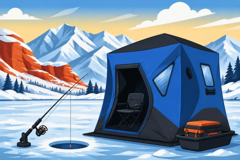
- Ice Fishing Safety: Even during ice fishing season, a GPS can be a lifesaver. It helps you mark safe access points, specific holes that produced fish, or dangerous areas of thin ice. While you'll always use an auger to check ice thickness, a GPS provides an extra layer of awareness. This is a topic explored more in-depth in our Utah Ice Fishing Guide.
In essence, integrating your GPS into every aspect of your fishing trip, from strategic fish-finding to safe navigation, elevates your overall experience and increases your chances of both success and a worry-free day on the water.
Choosing the Right GPS Unit for Your Fishing Style
With so many options, how do you pick the GPS unit that's perfect for your Utah fishing adventures? It really boils down to how you fish, where you fish, and what your budget looks like.
Considerations for Boat Anglers
If you primarily fish from a motorized boat, whether it's a bass boat, a dedicated fishing rig, or a large runabout, your needs will lean towards more robust and integrated systems.
- Integrated Sonar is Key: You'll want a chartplotter/fish finder combo unit. The ability to see fish arches, bottom structure, and depth contours in real-time, directly overlaid on your map, is invaluable. Look for advanced sonar technologies like DownScan, SideScan, or 3D mapping to give you the clearest picture of the underwater world.
- Screen Size and Power: Prioritize a larger screen (7 inches or more is a good starting point) for easy viewing and split-screen capabilities. Ensure the unit is powerful enough to handle rapid map redraws and seamless transitions between different views.
- Advanced Mapping Options: Invest in units that support high-definition bathymetric charts for Utah's key reservoirs. Some units offer community mapping features where you can contribute and download user-generated maps, which can provide hyper-local detail.
- Networking Capabilities: If you have (or plan to get) a trolling motor with GPS capabilities, radar, or other marine electronics, look for a unit that can network with these devices. This allows for features like "spot-lock" with your trolling motor, controlled directly from your chartplotter.
- Durability and Mounting: Ensure the unit is marine-grade, waterproof, and has a sturdy mounting bracket to withstand the vibrations and spray of boat travel. For a wide selection of these more advanced units, a specialty store like Bass Pro Shops is a great resource, offering various brands and models to compare.
Best Options for Shore and Wade Anglers
For those who prefer fishing from the bank, wading rivers, or hiking to remote high-country lakes, portability, durability, and battery life are paramount.
- Handheld GPS Units: These are your best bet. Look for models that are compact, lightweight, and have a robust, waterproof casing.
- Excellent Battery Life: Since you won't have a constant power source, a unit with extended battery life (15+ hours) or one that uses easily replaceable AA/AAA batteries is crucial. Always carry spare batteries or a portable power bank.
- Readable Screen: While smaller, ensure the screen is bright and easy to read in direct sunlight. Some models offer transflective displays that work well even without backlighting, saving battery.
- Basic Mapping is Often Sufficient: While detailed contour maps are great, for river wading or small lake fishing, a good topographic map showing trails, elevation changes, and general water bodies might be enough. Offline map downloads are critical if you'll be in areas without cell service.
- Smartphone Apps (with caveats): As a secondary or budget option, a smartphone app can work, but remember the limitations of battery drain and durability. Always use a rugged, waterproof case and carry an external battery pack. For handheld options, online retailers like Amazon offer a huge selection, allowing you to read reviews and compare specs easily before committing.
Budgeting for Your GPS Investment
GPS units for fishing range widely in price, from under $100 for basic handhelds or app subscriptions to several thousand dollars for top-of-the-line chartplotter/fish finder combos.
- Entry-Level (Under $200): You can find reliable basic handheld units that will mark waypoints, track routes, and offer fundamental mapping. Smartphone apps also fall into this category. These are great for beginners or those with simpler needs.
- Mid-Range ($200-$800): This segment includes more advanced handhelds with better screens and mapping, as well as entry-level boat combo units with decent sonar and mapping capabilities. This is often the sweet spot for many dedicated anglers.
- High-End ($800+): These are premium boat units with large, high-resolution screens, advanced sonar (SideScan, 3D), networking capabilities, and incredibly detailed mapping. These are for serious tournament anglers or those who demand the absolute best technology on the water.
Consider your fishing frequency and the types of waters you frequent. While it's an investment, a good GPS unit will pay dividends in saved time, increased catches, and enhanced safety for years to come. Think of it not just as an expense, but as a long-term investment in your passion for Utah fishing.
Here's a quick comparison of the common GPS unit types:
| Feature | Handheld GPS Unit | Chartplotter/Fish Finder Combo Unit | Smartphone GPS App |
|---|---|---|---|
| Portability | High (pocket-sized, lightweight) | Low (boat-mounted, requires power) | High (already in your pocket) |
| Primary Use | Hiking, wading, shore fishing, small boats | Motorized boats, advanced fishing | Casual use, backup, simple navigation |
| Sonar | None | Integrated, advanced (DownScan, SideScan, 3D) | None (some connect wirelessly to external sonar) |
| Screen Size | Small (2-4 inches) | Large (5-16+ inches) | Varies by phone (typically 5-7 inches) |
| Mapping Detail | Good for topo, basic lake contours | Excellent (highly detailed bathymetric charts) | Varies by app, often good with premium features |
| Power Source | AA/AAA batteries or internal rechargeable | Boat's 12V electrical system | Phone battery (drains quickly), portable chargers |
| Durability | Very high (rugged, waterproof) | High (marine-grade, waterproof) | Low (fragile, requires rugged case for protection) |
| Connectivity | USB for data transfer | Networkable with other marine electronics | Wi-Fi, Bluetooth, cellular data |
| Waypoint Storage | Hundreds to thousands | Thousands to tens of thousands | Varies by app, often cloud-synced |
Ultimately, a GPS unit is a fantastic tool that can truly transform your fishing experience in Utah. By carefully considering the type of fishing you do, the features that matter most to you, and your budget, you can find the perfect unit to guide you to more success and safer adventures on the water.
Disclaimer
This article is for general informational purposes only and does not constitute professional advice. Laws, prices and regulations vary by location and change over time. Consult a qualified professional for guidance on your specific situation.